

Geospatial software development is the engineering of applications that understand where things are. A delivery dispatcher who sees every van on a live map, a utility that plans pipe repairs by flood zone, a farm that varies fertilizer by field cell and a city that publishes zoning layers online all run on the same family of software: spatial databases, map rendering, geoprocessing and location-aware user interfaces.
Logistics is where most companies first feel the need for it. Fleet tracking, route planning, geofenced delivery proof and depot catchment analysis are geospatial problems at their core, which is why teams that offer custom logistics software development spend so much of their time on maps, coordinates and spatial queries. The same techniques power custom software development in energy, agriculture, real estate, insurance and government.
This guide is written for CTOs, product owners and operations leaders who are planning a GIS or location-based product. It covers:
- what geospatial and GIS software development means, and the main types of GIS applications;
- the features, industries and use cases that justify a custom build;
- the 2026 geospatial tech stack, standards, data formats and coordinate systems;
- ArcGIS vs Google Maps Platform vs Mapbox vs an open-source stack;
- an 8-step development process, data pipelines, architecture and legacy GIS migration;
- security and privacy of location data, cost, timelines and common mistakes.
What is geospatial software development?
Geospatial software development is the design and engineering of software that captures, stores, analyzes and visualizes data tied to a location on Earth. Every record has a geometry (a point, line or polygon) and a coordinate reference system, and the software answers questions such as "what is within 5 km of this depot?" or "which parcels intersect this flood zone?".
Three terms are often used interchangeably, but they are not quite the same:
| Term | What it usually means | Typical example |
|---|---|---|
| GIS software development | Building or extending geographic information systems: layers, editing, spatial analysis, cartography | A utility network editor, a municipal parcel viewer, a QGIS or ArcGIS plugin |
| Geospatial software development | The broader category: any software that processes location data, including imagery, sensors and analytics pipelines | A satellite imagery change detection service, a geospatial data lake, a spatial API |
| Location intelligence / location-based apps | Business applications where maps and location drive decisions or user features | Store site selection, fleet tracking, delivery ETAs, geofenced notifications |
In practice a single product often mixes all three. A fleet platform stores GPS pings in a spatial database (geospatial), shows vehicles and zones on a web map (GIS) and uses travel time to promise delivery windows (location intelligence).
Types of geospatial and GIS software
Most GIS software projects fall into one of seven types, and the type determines the stack, the team and the budget more than the industry does. Naming the type early prevents a common mistake: scoping a heavy desktop-style GIS when users only need a fast web map with three layers.
| Type | What it does | Typical users |
|---|---|---|
| Web GIS portals and map viewers | Publish layers, search, filter, measure and share maps in the browser | Public agencies, utilities, real estate teams, customers |
| Mobile and field data collection apps | Capture points, photos and forms in the field, often offline, with GNSS accuracy | Surveyors, inspectors, field technicians, agronomists |
| Tracking and routing platforms | Live vehicle or asset positions, geofences, route planning, ETAs | Dispatchers, fleet managers, delivery companies |
| Spatial analytics and location intelligence | Heatmaps, catchments, site selection, risk scoring by area | Retail planners, insurers, analysts |
| Remote sensing and imagery processing | Process satellite, aerial or drone imagery; detect objects and change over time | Agriculture, energy, environmental and defense teams |
| Spatial APIs and data services | Geocoding, reverse geocoding, tile and feature services for other apps | Developers and partner systems |
| Desktop GIS extensions and plugins | Custom tools and workflows inside QGIS or ArcGIS Pro | Professional GIS analysts |
What features does custom GIS software need?
Custom GIS software needs a small set of core spatial features plus the business workflow around them; the workflow, not the map, is usually what makes the product valuable. A map that shows assets is a commodity. A map that tells a dispatcher which job to assign next is a product.
Core features that appear in most geospatial applications:
- Interactive map: base maps, layer control, zoom, pan, clustering of dense points, vector tiles for fast rendering.
- Search and geocoding: address search, reverse geocoding of coordinates, place autocomplete.
- Spatial queries: within distance, intersects, contains, nearest neighbor, buffers and isochrones (areas reachable in N minutes).
- Geofencing and alerts: enter or exit events for vehicles, people or assets, with notifications and audit logs.
- Editing and data capture: draw and edit geometries, attach photos and forms, validate topology, work offline in the field.
- Routing: shortest or fastest paths, multi-stop optimization, truck restrictions; see our route optimization software development guide for the algorithms.
- Analytics and reporting: heatmaps, area statistics, time sliders, exports to CSV, GeoJSON or Shapefile.
- Roles and permissions: who can see which layers, regions or customers, which matters as soon as several clients share one platform.
Industries and use cases for geospatial software
Geospatial software pays off wherever decisions depend on distance, area or position, which covers most physical industries. The table below lists the use cases we see most often in 2026 requests and links to deeper industry guides.
| Industry | Typical geospatial use cases | Related guide |
|---|---|---|
| Logistics and transportation | Fleet tracking, route planning, geofenced proof of delivery, depot catchments | Fleet management software, last-mile delivery apps |
| Energy and utilities | Network asset registers, outage maps, vegetation and right-of-way monitoring, solar siting | Energy software development |
| Agriculture | Field boundaries, yield maps, variable-rate prescriptions, satellite crop health (NDVI) | Agriculture software development |
| Real estate and proptech | Parcel and zoning lookup, comparables by area, portfolio maps, site selection | Real estate software development |
| Government and smart cities | Public map portals, permits by parcel, 311 issue maps, emergency response | Government software development |
| Insurance | Flood, wildfire and hail exposure scoring, claims mapping after events | Spatial risk models on top of hazard layers |
| Telecom and IoT | Coverage maps, tower planning, sensor networks with positions | IoT software development |
Geospatial tech stack in 2026
A modern geospatial stack has five layers: storage, processing, serving, client and analytics, and most custom projects in 2026 combine open-source components with one commercial map or data provider. The open-source core is mature enough that licensing is now a choice, not a constraint.
| Layer | Common choices in 2026 | What it is for |
|---|---|---|
| Spatial database | PostgreSQL + PostGIS (3.6 released September 2025), SQL Server spatial, Oracle Spatial, BigQuery GIS, Snowflake geospatial | Store geometries, index them and run spatial SQL |
| Processing and ETL | GDAL/OGR, Python with GeoPandas, Shapely and Rasterio, PDAL for point clouds, Apache Sedona for big data | Convert formats, reproject, clean and analyze vector and raster data |
| Map and feature serving | GeoServer, pg_tileserv, Martin, TiTiler, ArcGIS Enterprise, PMTiles on object storage | Serve vector tiles, raster tiles and feature APIs to clients |
| Web client | MapLibre GL JS, OpenLayers, Leaflet, deck.gl, CesiumJS for 3D, ArcGIS Maps SDK for JavaScript, Google Maps JavaScript API | Render maps and interactions in the browser |
| Mobile client | MapLibre Native, Mapbox Maps SDK, Google Maps SDK, ArcGIS Maps SDKs for Swift and Kotlin, Flutter map plugins | Native maps, offline areas, GNSS input |
| Analytics and indexing | H3 hexagonal index, DuckDB spatial, GeoParquet files, Jupyter notebooks | Aggregate millions of points, build heatmaps and catchments |
| Desktop | QGIS (version 4.0 released in March 2026), ArcGIS Pro | Analyst work, data preparation, quality checks |
Around this core sits the usual application stack: a backend in Python, Node.js, Go or .NET, a frontend in React or Vue, and cloud infrastructure. Our comparison of web app tech stacks in 2026 covers those general choices; the geospatial layers above are what make the product spatial.
Standards, data formats and coordinate systems
Geospatial software only works reliably when it follows open standards for services, file formats and coordinate reference systems; most "the map is off by 200 meters" bugs come from ignoring them. Standards also keep your data portable if you later change vendors.
OGC service standards
The Open Geospatial Consortium (OGC) publishes the interfaces that GIS clients and servers use to talk to each other. The classic ones are WMS (map images), WMTS (cached map tiles) and WFS (vector features). The newer OGC API family replaces XML with REST and JSON: OGC API – Features Part 1 Core is also published as ISO 19168-1:2020, and further parts add coordinate systems by reference and filtering. If a client or a government partner asks for "OGC compliance", these are the interfaces they mean.
Cloud-native data formats
Cloud-native formats let browsers and services read only the part of a file they need over HTTP, which removes whole server layers. The four worth knowing in 2026:
- Cloud Optimized GeoTIFF (COG): an OGC standard for raster imagery that supports partial reads by range request.
- GeoParquet: adds geometry types to Apache Parquet for fast analytical queries on large vector datasets.
- PMTiles: a single-file archive of map tiles that can be served straight from S3-type storage, no tile server needed.
- GeoJSON and GeoPackage: the everyday exchange formats for features; Shapefile remains common in legacy data but has field name and size limits.
Coordinate reference systems
Store data in a well-defined coordinate reference system and convert only for display. EPSG:4326 (WGS 84 latitude and longitude in degrees) is the usual storage and GPS format. EPSG:3857 (Web Mercator) is what web maps display, and it distorts area heavily away from the equator, so never calculate areas or distances in it. For accurate measurements use a local projected system or geography types in PostGIS.
Spatial indexes
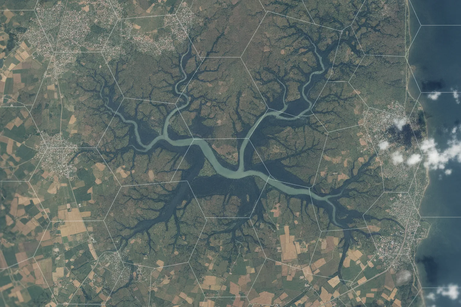
Spatial indexes make "what is near here" queries fast. PostGIS uses R-tree style GiST indexes for geometries. For analytics, Uber's open-source H3 grid divides the globe into hexagons at 16 resolutions, from 122 cells at resolution 0 to roughly 570 trillion at resolution 15, which makes aggregation and joins of huge point datasets cheap.
ArcGIS vs Google Maps vs Mapbox vs open source
The right platform depends on who your users are, how many map loads you expect and whether you need professional GIS editing; there is no single best option. Many products end up hybrid: an open-source core for data and serving, plus a commercial provider for base maps, geocoding or traffic.
| Option | Strengths | Watch out for | Best fit |
|---|---|---|---|
| Esri ArcGIS (Online, Enterprise, Maps SDKs) | Full professional GIS, editing, analysis, strong in government and utilities, rich content | Per-user and credit-based licensing, vendor lock-in, heavier learning curve | Organizations that already run Esri, regulated public-sector work |
| Google Maps Platform | Familiar base maps, best-in-class places and geocoding data, traffic-aware routing | Usage-based pricing per SKU; terms restrict storing and mixing some data | Consumer and customer-facing apps with address search |
| Mapbox | Highly customizable vector maps, navigation SDKs, good mobile support | Mapbox GL JS v2 and later are under a proprietary license; usage-based pricing | Branded consumer apps, navigation, design-heavy maps |
| Open source (PostGIS, GeoServer or Martin, MapLibre, OpenStreetMap data) | No license fees, full control of data, portable, large community | You operate and update everything; base maps and geocoding need hosting or a provider | High-volume B2B platforms, data-sensitive products, long-lived systems |
Pricing changed in 2025 and should be checked before you commit. Since 1 March 2025, Google Maps Platform has replaced its $200 monthly credit with free monthly usage thresholds per SKU: 10,000 billable events for Essentials SKUs, 5,000 for Pro and 1,000 for Enterprise. For a dispatcher tool with 50 users this is rarely an issue; for a public app with millions of map loads, API fees can exceed hosting costs, which is a common reason to move base maps to MapLibre with self-hosted or third-party vector tiles.
How to build geospatial software: 8 steps
Building geospatial software follows the normal product lifecycle, with extra steps for data sourcing, coordinate systems and map performance that general teams tend to underestimate. The sequence below is the one we use for GIS and location-based projects.
- Define the spatial questions. Write down the questions users must answer ("which jobs are within 30 minutes of this technician?") and the decisions they will make. This drives everything else.
- Inventory and assess the data. List every source: GPS feeds, CAD drawings, Shapefiles, imagery, open data, third-party layers. Check coverage, accuracy, update frequency, licensing and coordinate systems.
- Choose the platform and stack. Decide between ArcGIS, a commercial map API, open source or a hybrid, based on users, volume, editing needs and data sensitivity.
- Design the data model and architecture. Geometry types, CRS, spatial indexes, tile strategy, how real-time positions flow in, and how layers are secured per role or customer.
- Build the data pipeline. ETL jobs that import, clean, reproject and validate data on a schedule, with quality checks before anything reaches users.
- Develop the application. Backend APIs, map UI, mobile and offline capture, integrations with ERP, CRM, TMS or IoT platforms. Ship a thin vertical slice early to test performance on real data.
- Test spatial accuracy and performance. Beyond usual QA: verify positions against known control points, test with production-size datasets, measure tile and query latency, and test offline sync conflicts.
- Deploy, monitor and maintain. Monitor API usage and fees, data freshness and slow queries; plan regular updates of base maps, reference layers and libraries.
For a first release, a scoped MVP that answers two or three spatial questions on real data is safer than a full GIS. It validates data quality and user adoption before the expensive parts are built.
Geospatial data quality and pipelines
Data work is usually the largest hidden cost in a geospatial project, because location data arrives in mixed formats, projections and quality levels. A beautiful map on top of wrong data is worse than no map, because people trust it.

Typical data problems and how a pipeline handles them:
| Problem | Example | Pipeline fix |
|---|---|---|
| Unknown or wrong projection | A Shapefile without a .prj file lands in the ocean | Require CRS metadata, detect by extent, reproject with GDAL |
| GPS noise and drift | Vehicle pings jump across a highway or sit in a building | Filter by speed and accuracy, snap to roads (map matching) |
| Invalid geometries | Self-intersecting polygons break area calculations | Validate and repair (ST_MakeValid), log rejects |
| Duplicate or stale records | Two versions of the same parcel from different years | Stable IDs, effective dates, change detection on import |
| Licensing limits | Provider terms forbid caching geocoded results | Track source and license per layer, choose open data where possible |
| Huge volumes | Billions of telemetry points per year | Partition by time, aggregate with H3, archive raw data to GeoParquet |
Field data deserves special care. Mobile collection apps should record device accuracy, timestamps and the user for every point, and work offline with conflict resolution when two people edit the same feature. Our mobile app development team builds this kind of offline-first field app on iOS, Android and Flutter.
Architecture and scalability for GIS applications
Scalable GIS architecture separates three workloads: real-time ingestion of positions, map serving and heavy spatial analysis, because each scales differently. Mixing them in one database and one API is the usual reason a map that was fast in the demo becomes slow with real fleets.
- Ingestion: GPS and IoT messages go through a queue or stream (MQTT, Kafka or a managed equivalent), are validated and written in batches; latest positions live in a fast store for live maps.
- Serving: static layers are pre-rendered as vector tiles or PMTiles behind a CDN; dynamic layers come from a tile server with caching and strict zoom limits.
- Analysis: long-running spatial jobs run as background workers or in an analytical store such as DuckDB, BigQuery or Sedona, never on the transactional database during working hours.
- Multi-tenancy: each customer's features are filtered by tenant at query and tile level, not only in the UI.
- Observability: track tile latency, slow spatial queries, map API calls per customer and data freshness per layer.
A useful rule of thumb: if the browser has to download more than a few thousand individual features to draw a layer, switch that layer to vector tiles or server-side clustering.
Modernizing and migrating legacy GIS
Legacy GIS modernization usually means moving desktop or on-premises GIS workflows to web and cloud, and often replacing expensive licenses with open-source components where it makes sense. The data, not the code, is the hard part to migrate.
Common migration scenarios we see:
- Desktop to web: analysts' QGIS or ArcMap projects become a web portal for the wider business, with editing limited to trained roles.
- Oracle Spatial or SQL Server to PostGIS: lower licensing cost and a larger ecosystem; requires mapping data types and rewriting spatial SQL.
- ArcGIS Enterprise to a hybrid stack: keep Esri for professional editing, serve public maps with MapLibre and vector tiles.
- Monolith to services: separate ingestion, tiles and analytics so each can scale on its own.
Run the old and new systems in parallel for a period, compare query results on the same data and migrate users layer by layer. Our guide to legacy system modernization covers the general strategy, cost and ROI logic that also applies to GIS.
Security and privacy of location data
Location data is personal data in most jurisdictions, so geospatial software must be designed with privacy and access control from the start. A history of where a driver or customer has been reveals home addresses, routines and sometimes health or religious information.
- GDPR: location data is explicitly named in the definition of personal data (Article 4(1)), so tracking needs a legal basis, purpose limitation and retention limits.
- California (CCPA as amended by CPRA): precise geolocation, defined as within a radius of 1,850 feet, is sensitive personal information with extra rights for consumers.
- Employee tracking: track drivers and field staff only during working hours, tell them what is collected and why, and give managers aggregated views where possible.
- Technical controls: role- and tenant-based layer security, encryption in transit and at rest, audit logs for who viewed location histories, and coarsening or aggregation (for example to H3 cells) for analytics.
- Critical infrastructure: utility and energy network maps can be sensitive; restrict public layers and review exports.
This is general information, not legal advice; involve counsel for your specific markets.
How much does geospatial software development cost?
Geospatial software development costs from a few thousand dollars for a simple map feature to several hundred thousand for an enterprise GIS platform, and the main drivers are data work, integrations and real-time scale rather than the map itself. Ongoing map API, hosting and data license fees must be added to the build cost.
| Project scope | Example | Indicative starting budget and timeline |
|---|---|---|
| Map module in an existing system | Customer or asset map with search and filters inside a corporate system | From $2,900, 6–10 weeks (YuSMP corporate system starting price) |
| Multi-role web GIS portal | Portal with layers, roles, editing and exports for staff and clients | From $10,400, 14–22 weeks (YuSMP portal starting price) |
| Mid-market logistics or field platform | Fleet tracking, geofencing, routing, mobile app and integrations | $50k–$150k over 3–6 months |
| Enterprise geospatial platform | Multi-tenant platform with real-time ingestion, analytics and imagery | $150k–$500k over 6–12 months; $500k+ when GIS is the product itself |
What moves the price up or down:
- Data preparation: number of sources, their quality and the need for manual cleanup or digitizing.
- Real-time requirements: live tracking of thousands of assets needs streaming infrastructure and careful scaling.
- Integrations: ERP, TMS, CRM, telematics providers, IoT platforms and government data feeds.
- Offline mobile capture: sync and conflict resolution add significant effort compared with online-only apps.
- Imagery and AI: object detection on satellite or drone imagery requires labeled data, model training and GPU processing.
- Running costs: map API usage, geocoding, routing, tile hosting, imagery subscriptions and data licenses, which can be monthly line items for the life of the product.
For wider context on rates and project sizes, see our software development cost benchmark for 2026. The starting prices above come from our published service pages; a final quote depends on scope.
Common mistakes in GIS software projects
Most failed GIS projects fail on data, scale or licensing assumptions, not on code. The seven mistakes below are the ones we most often see when we are asked to rescue or rebuild a geospatial product.
- Calculating distances or areas in Web Mercator. Results can be wrong by tens of percent at northern latitudes.
- Loading all features into the browser. Works with 500 points in the demo, freezes with 50,000 in production.
- Ignoring map API pricing. A public launch turns a free tier into a large monthly invoice.
- No data ownership plan. Nobody is responsible for updating layers, so the map quietly goes stale.
- Breaking provider terms. Caching or storing geocoding results or mixing data from providers that forbid it.
- Treating GPS as truth. No filtering of noisy positions, so geofence alerts fire falsely and drivers stop trusting them.
- Building a full GIS when users need one workflow. Months spent on generic tools that nobody uses.
How to choose a GIS software development partner
Choose a GIS development partner by checking spatial depth, not just general web skills: ask how they handle projections, tiles, data quality and map API costs. A team that cannot answer those questions in the first call will learn them on your budget.
A short checklist for vendor calls:
- Can they show a geospatial product in production and explain its data pipeline?
- Do they recommend a platform based on your users and volume, or always the same one?
- How do they store coordinates, which CRS, and how do they calculate distances?
- How will the map perform with your real data volume, and how will they test it?
- What will map APIs, hosting and data licenses cost per month after launch?
- How do they secure location data and meet GDPR or CCPA requirements?
- Who owns the code, data models and tile pipelines at the end of the project?
FAQ: geospatial software development
What is geospatial software development?
Geospatial software development is building software that captures, stores, analyzes and displays location-based data, such as web and mobile maps, tracking and routing platforms, spatial analytics and imagery processing. It combines spatial databases like PostGIS, processing libraries like GDAL and map clients like MapLibre or ArcGIS.
What is the difference between GIS and geospatial software development?
GIS software development focuses on geographic information systems: layers, editing, spatial analysis and cartography. Geospatial software development is the broader term and also includes imagery processing, sensor data pipelines, location intelligence and spatial APIs. Most real projects combine both.
Which programming languages are used for GIS software development?
Python is the most common language for geospatial processing and analysis, with GDAL, GeoPandas, Shapely and Rasterio. JavaScript or TypeScript is used for web maps with MapLibre, OpenLayers or the ArcGIS Maps SDK. SQL with PostGIS handles spatial queries, and Swift, Kotlin or Flutter are used for mobile field apps.
How much does it cost to build GIS software?
A map module inside a corporate system starts around $2,900, a multi-role web GIS portal from about $10,400, a mid-market logistics or field platform typically costs $50,000 to $150,000, and enterprise geospatial platforms run $150,000 to $500,000 or more. Map API, hosting and data license fees come on top.
How long does geospatial software development take?
A simple map feature takes 6 to 10 weeks, a web GIS portal 14 to 22 weeks, and a full logistics or field operations platform 3 to 6 months for the first release. Enterprise platforms with real-time ingestion and analytics usually take 6 to 12 months.
Should I use ArcGIS, Google Maps or open source?
Use ArcGIS if your organization already runs Esri or needs professional GIS editing, Google Maps Platform for consumer apps that rely on address search and places data, and an open-source stack with PostGIS and MapLibre for high-volume or data-sensitive B2B platforms. Hybrid setups are common.
Is location data considered personal data?
Yes, in most cases. The GDPR names location data in its definition of personal data, and California's CCPA as amended by the CPRA treats precise geolocation as sensitive personal information. Geospatial software should collect only what is needed, limit retention and control who can see location histories.
Sources: standards, platforms and regulations
- OGC API – Features (Open Geospatial Consortium)
- OGC Cloud Optimized GeoTIFF standard
- GeoParquet specification
- H3: tables of cell statistics across resolutions
- Google Maps Platform: billing and pricing FAQ (March 2025 changes)
- PostGIS news and releases
- QGIS release roadmap
- EPSG:3857 WGS 84 / Pseudo-Mercator
- GDPR Article 4: definitions
Published 17 November 2026. Versions, pricing thresholds and regulatory definitions come from the cited sources and should be rechecked before purchase decisions. YuSMP Group prices are starting prices published on our service and industry pages; final quotes depend on scope. This article is not legal advice.